The AirIndia flight from Guwahati to Dimapur almost at dawn is a short and non-descript affair. Dimapur airport looks fairly big, though traffic is on lower side. One can notice massive growth of grass very close to the terminal building. It defies any justification.
Two young officers of NEPED, an authority of Govt. of Nagaland (primary concern–energy and environment), warmly receive me. Though baggage clearance is a time taking affair, the serene and hassle free atmosphere in the arrival hall is a welcome wind of change. Drive to designated hotel is not a long affair. Getting into an almost brand new Bolero reminds me of hilly terrain of Sikkim. Looking at pools of water, I am informed of the rain that took place previous evening and early morning.
The private hotel at Dimapur looks impressive, neat and clean. Presence of a few foreign ‘smoking’ women gives an indication that tourism in this part is surviving if not ensuring economic returns to the common man. The service, however, is discouraging. As a result, we have to spend more than an hour to have breakfast and a short meeting with CCS, Planning, Govt. of Nagaland and his Joint Secretary, also associated with NEPED. On their suggestion, we decide to go to Tuensang via Golaghat in Assam. It is in contrast to the usual route via Kohima (76 kms), the state capital. Latter is supposed to be longer and more time consuming.
Sharp at 9.30 am, we leave the hotel to pass through 6 to 8 kms of completely flat portion of Dimapur. Population, at this time of the day looks sparse. In no time we enter Karbi Anglong Dist. of Assam. In the beginning it is Khatkhati village, followed by Bokajan, having an Army check post and a CCI cement factory. Next, we see a diversion for Numaligarh and Goalpara. It is a smooth drive on a good road, presumably, as it is a Sunday. Paddy fields are on both sides. After sometime one can see hills also as a backdrop.
By 10.10 am we reach Balipathar. The road sign indicates as if we are close to Jorhat Dist. Piles of firewood over machans remind me of similar practise followed between Muri and Ranchi in Jharkhand. The sight of black flags on vehicles surprises. One presumes that there is some cause for protest. But Takum Chang of NEPED informs that someone may have died and the burial may not have got over. Variety of small vehicles and pickup vans bearing both Assam and Nagaland number plates are negotiating slightly serpentine road going through thick patch of forest. One is reminded of roads of Middle Andaman in Jarawas area.
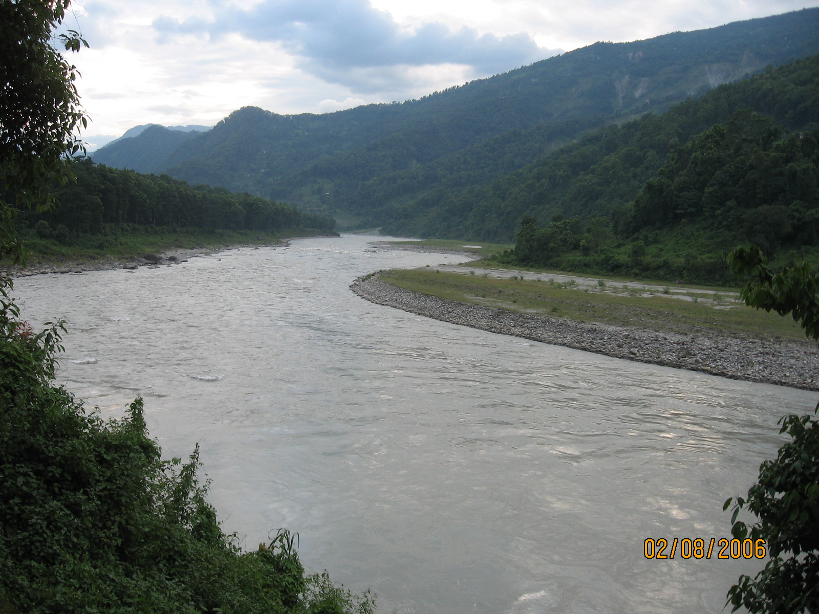
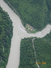
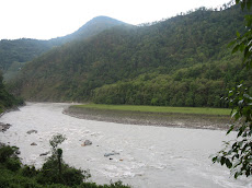
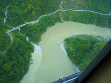
The river Garampani next catches our attention. A prominent board shows that there is a wild life sanctuary stretching upto Kaziranga. Around 10.40 hrs., one mile stone indicates that Numaligarh is only 45 kms away. Suddenly, a Mongoose crosses the road. It wakes up one of the officers from sleep. A village of Golaghat Sub- division thereafter comes before our eyes. A tri-junction (Tinaili) indicates that Golaghat town is barely 7 kms away while Numaligarh and Guwahati are located at a distance of 30 and 272 kms respectively. Once we shift from National Highway to the State highway, the condition of road can be very well imagined.
Golaghat, HQ of a District by the same name, is a sleepy one, having less of population and activity. The office, court complex and shops have nothing fresh to show. On seeing elevated foot path over drains, one remembers Guwahati. After all, these are high rainfall areas needing proper drainage. Negotiating pedestrians, our driver appears fairly confident in finding out correct approach to Mariani. But he falters. We get diverted. Upon asking local residents time and again, we hit the right direction.
By 12.15 pm we reach Titabari. Boards all over are mostly in Assamese language. This looks like a typical ‘Kasba’. Hills of Mokokchung are now clearly visible behind the paddy fields. Road condition improves gradually. Soon we see plenty of tea gardens on both sides. I am tempted to drop down twice to take snaps. The beauty of the place prompts me to speak to Ankoor. He listens more than he talks. Probably, I should have more ‘material’ to report to him and his mother, may be, after reaching Tuensang.
Mariani town is the last settlement of Assam before we enter Mokokchung Dist. around 12.45 hrs. We take a right turn from Mariani College, well past the HQ of 752 Border Road Task Force. The huge hoarding displays that Mokokchung town was 85 kms, while Tuensang was 185 kms. Before we venture into hilly areas of Nagaland, it was a good decision to fill up our belly with whatever snacks we could get at a road side dhaba. Offer of free fresh red chillies from the owner was something unusual.
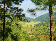
Around 1 pm we enter Dissoi Valley Reserve Forest of Nagaland. Gradual climb begins. Drive through the forest dominated by bamboo plantation is memorable. I do not forget to capture the beauty in my mobile camera. Soon heat of plains gives way to coolness of hills. Within half an hour we are stopped at a Army check post. I am told, it is going to be a regular feature. While we chit-chat with the Jawans, we also break monotony by having tetra pack cold drinks brought so affectionately by the NEPED officers.
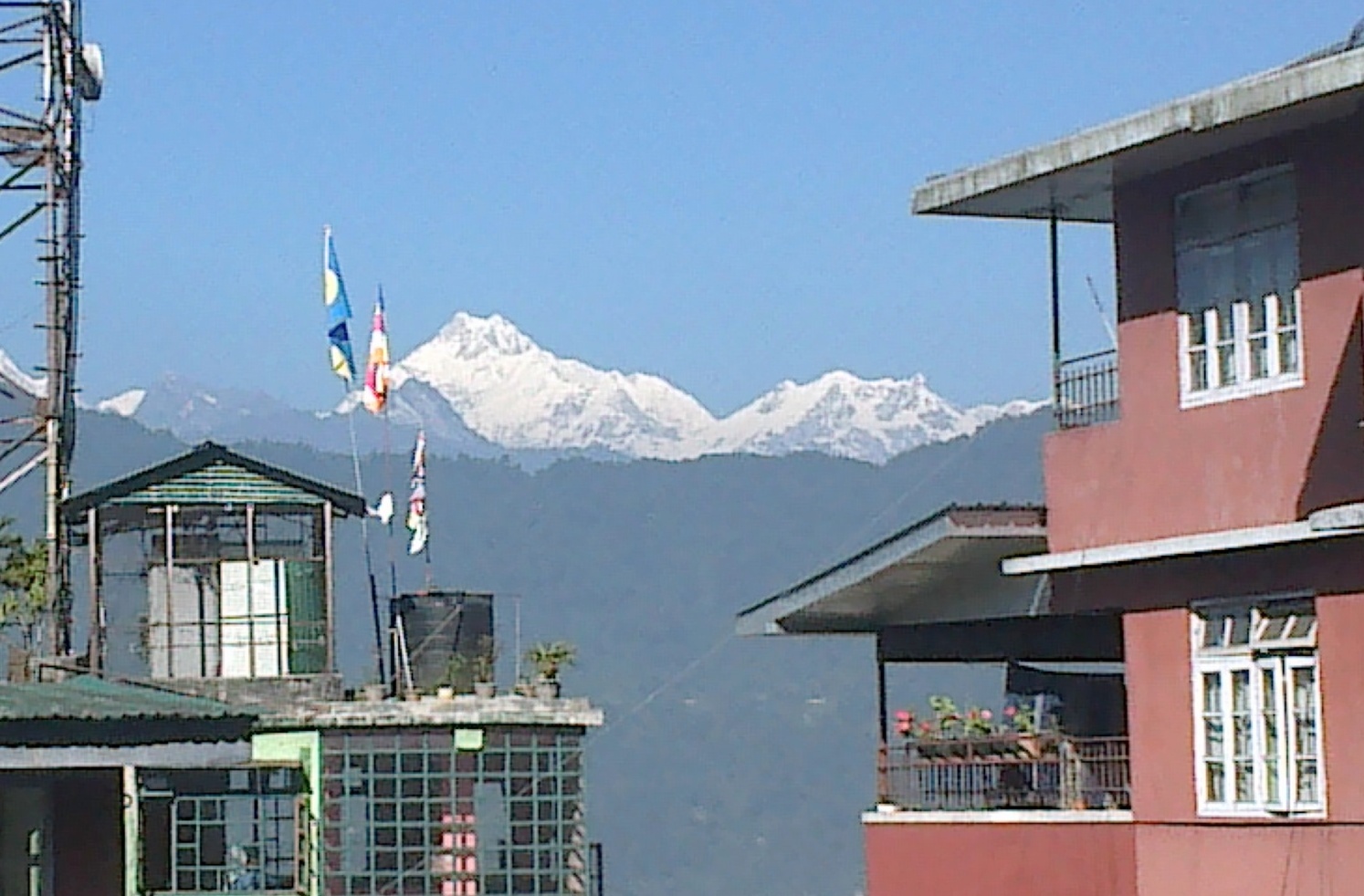
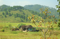
By 1.50 pm we gather sufficient height to reach Changki. The beautiful scenario from top encourages me to shoot again. View of traditional huts in the midst of paddy fields looks mesmerizing. I am informed that Changki is dominated by Aao tribe, one of the 13 major tribes of Nagaland. High literacy percentage among the tribesmen has ensured their sizeable presence in bureaucracy. Though the main village over a hillock on the right hand side looked attractive, we did not have enough time to resort to a diversion. Within half an hour, we manage to reach New Camp, which enables us to have the first bird’s eye view of Mokokchung.
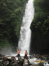
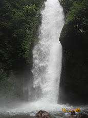
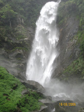
Just before 3 pm, finding no way side eatery on account of today being Sunday, we stop very close to an apology to a waterfall to consume the food stuff ‘saved’ from Dimapur. While we all enjoy sharing the food and drinking the natural ‘mineral’ water, adequate care is taken of the driver, for, he was to negotiate another 5 hrs. of tough hilly terrain. Subsequently, we pass through Chungtia and Khensa villages, both having few houses. View of orange trees and green grassy land on the other side of the valley was simply amazing.
Sharp at 3.40 pm we enter Mokokchung. Situated at a height of 1360 meters, it appears to be a typical hill station with a couple of Churches, perched atop prominent locations. Old world charm and shades of modernity are seen co-existing. Though streets look deserted due to Sunday, it is nice to see a bunch of boys and girls making a bee-line for tuition. A few mothers in traditional dresses are also witnessed feeding and grappling with their tiny tots. Before sunset becomes imminent, we refill our petrol tank.
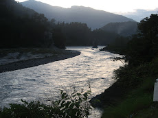
By the time we manage to drive down to the Dikhu river (4.30 pm), the boundary of Tuensang Dist., it has become dark. The road along this side of the state is not only narrow but same abounds in pot-holes. Occasionally landslide points are also visible in an area that looks otherwise stable. Drive, per se, is so slow that it takes one hour and fifteen minutes to cover 25 kms. We get much needed relief from apparent boredom and fatigue when we manage to enter Chare around 5.10 pm. It is an over grown village, once again having churches and plethora of traditional houses. A few barking dogs break the solitude.
Upon giving ourselves a little bit of breathing space, we prepare mentally for the last phase of journey stretching to 60 kilometres. Condition of road further deteriorates. One learns that this National Highway leading to Myanmar border through Tuensang is repaired and re-laid almost every year, alternatively by the State PWD and the GREF. Though many more villages are passed through in pitch dark situation, villages of Yangli and Longkhim (habitat of Sangtam tribe) are reported to be of some significance.
At long last, around 7.30 pm we get the first view of Tuensang. But for reaching this remote Dist. HQ, one has to negotiate a tough sinking point. By the time we enter the town, most of the doors have shut down. Practically there is no pedestrian movement. Fortunately, there is electricity even if voltage is on lower side. From the main square, we drive upwards, looking for the Circuit House. On learning about location of the Bungalow of D.C. on to our left, we try to find out if he was in town. We get a negative response from the half asleep watchman. By 7.50 pm we reach Circuit House, located at an altitude of 1791 meters. Before alighting one does not forget to put on woollens. The House having 5 rooms with a reasonable size compound, however, has no catering facility. One of my hosts, therefore, volunteers to wake up his mother-in-law in search of dinner. A futile attempt is made to ring up Ankoor and D.T.
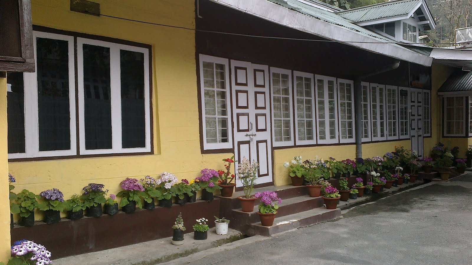
Subsequent to rest and relaxation for an hour, we drive down to the traditional house owned by the in-laws of Takum Chang. Except us, everyone else in town has supposedly hit the pillow. The typical Ekra construction, look of the drawing room and impressive spirit of hospitality once again bring back memories of Sikkim. We finish eating tasty food in roughly half an hour and bid good bye by profusely thanking the hosts. But for them, we would have remained hungry whole night. The challenging moments of the journey so far shall not deter me from visiting 8 to 10 villages in next three days to assess changing livelihood patterns of the people, I utter so, prior to switching off the dim lights. Temperature had come down drastically, but not my spirits.


.JPG)


.jpg)


.JPG)


.JPG)


.JPG)